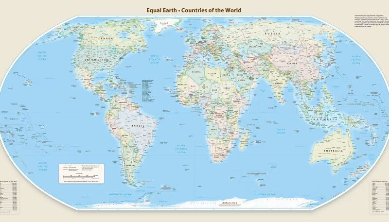


The Equal Earth projection accurately reflects countries' relative sizes. (PHOTO CREDIT: Equal Earth) The United Nations General Assembly has voted to adopt a new world map that more accurately depicts Africa’s size. The decision followed a call by African countries for the UN to right the centuries-old wrong. Togo introduced the resolution to the assembly about a year after the African Union endorsed it.
The resolution is part of the #CorrectTheMap campaign backed by all 55 African Union member states. The resolution seeks to replace the traditional Mercator map, which distorts the region, with the Equal Earth projection, which is believed to show countries’ true sizes. It calls for an “equitable” representation of the globe’s regions, particularly Africa.
It also argues that the way the world map is drawn makes the continent seem smaller and less important in people’s minds. The Equal Earth projection, developed in 2018, is considered to show countries and continents in proportions equal to their actual surface areas. The Guardian reports that it presents Africa much closer to its true scale.
Meanwhile, the Mercator map, created in 1659, shows Greenland as roughly comparable in size to Africa, even though Africa is about 14 times larger. Historians and geographers have long said the Mercator projection is rooted in Western stereotypes. Activists have echoed and made similar arguments, with some coining the term “cartographic colonialism”. At the UN General Assembly, the resolution passed with overwhelming support. 164 member states voted in favour.
This includes Nigeria, Togo, Ghana, Morocco, and 50 other African member states. Germany, France, Turkey and the United Kingdom also voted in support of the resolution. However, The US voted against the resolution, with its representative describing it as “superfluous.”